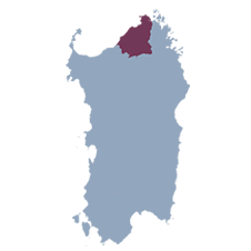


Home » Aglientu
AGLIENTU
SANTU FRANCÌSCU DI L'AGLIÈNTU
The town of Aglientu originated in the second half of the 18th century, with the construction of the Church of San Francesco in 1776, commissioned by Victor Amadeus III of Savoy. The church quickly became a central point for community life and a refuge for shepherds, who during winter led their flocks to coastal pastures, thus avoiding the difficulties of transhumance. Around the church, small community structures called “cucine” (kitchens) were built, used for social gatherings and fairs that accompanied religious celebrations. Over time, artisans from Tempio Pausania began to frequent the place, contributing to the development of the area.
It was only around 1850 that some wealthy families chose to build permanent homes near the church, marking the beginning of a true village. This initial nucleus included a central square, the church, three kitchens, two shops, a mill, and the houses of local artisans, all in an economic context still characterized by self-production and life in the “stazzi,” typical of the pastoral tradition of Gallura.
In the 1960s, the original church was demolished and replaced with a modern building. In 1959, Aglientu gained administrative independence from Tempio Pausania, becoming an autonomous municipality named “San Francesco d’Aglientu,” later shortened to simply Aglientu in 1968. This change marked a significant transformation for the community, from a cultural, economic, and political perspective, thanks also to the initiative of local inhabitants.
Today, Aglientu preserves a rich historical and environmental heritage. The territory hosts monuments dating back to the Nuragic era, remains of Spanish domination, and various rural churches such as those of San Pancrazio, San Biagio, San Giovanni, and San Silverio. Aglientu’s coastal area, which extends for about 22 km, is famous for beaches like Rena Majore and Monti Russu, and includes the SIC area of Monte Russu, a stretch of coast protected for its beauty and biodiversity.


MUSEUMS OF THE
TERRITORY

ARCHAEOLOGICAL NATURE AREAS
Coordinates
Altitude
Area
Inhabitants
Hamlets
Patron Saint
420 meters above sea level
148.56 km2
1.207
San Francesco

 e poi
e poi