


Home » Luras
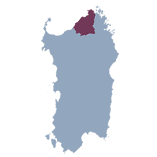
Luras is situated in an extensive hilly granite territory at an altitude of 508 meters. The area features a varied landscape composed of Mediterranean scrub, cork oak forests, vineyards, pastures, and granite reliefs. The most important watercourse is the riu Carana, which longitudinally crosses the Luras territory and forms the artificial basin of Liscia.
The toponym Luras oscillates between the Logudorese form Lurasa (from Latin lura, ura, meaning wineskin, sack) and the less common Gallurese form, Luris. From the first half of the 14th century, the term Luras is documented in Pisan and Aragonese registers, where it first appears with the toponyms Villa Lauras, Lunas, and Luras. However, traces in the territory attest to much older human habitation, dating back to prehistoric times. There are several prehistoric monuments, including dolmens, nuraghi, and giants’ tombs. In the Carana area, there are two monumental wild olive trees. The most important, s’Ozzastru, has an estimated age of about 4000 years and was declared a Natural Monument in 1991. Traditional agricultural and commercial activities, with the sale of wool, hides, cork, iron, wines, etc. throughout the island, contributed to economic well-being, evident in public and private constructions such as roads, fountains, palaces, and stately homes.
Today, it maintains a certain economic prosperity linked to the tertiary sector, agriculture, and livestock farming, while viticulture has taken on an increasingly important role, achieving recognition at national and international levels.
Coordinates
Altitude
Area
Inhabitants
Hamlets
Patron Saint
508 m above sea level
87.59 km2
2371
n/a

INSTALLA L'APP{/bold}} Gallura città di paesi sul tuo telefono  e poi aggiungila alla schermata Home
GALLURA Città di Paesi
galluracittadipaesi.it
June 19, 2026
Stato di conformità
Crediamo fermamente che Internet debba essere disponibile e accessibile a chiunque e ci impegniamo a fornire un sito Web accessibile al pubblico più vasto possibile, indipendentemente dalle circostanze e dalle capacità.
Per raggiungere questo obiettivo, miriamo ad aderire il più rigorosamente possibile alle Linee guida per l'accessibilità dei contenuti Web 2.1 (WCAG 2.1) del World Wide Web Consortium (W3C) a livello AA. Queste linee guida spiegano come rendere i contenuti web accessibili alle persone con un'ampia gamma di disabilità. Il rispetto di tali linee guida ci aiuta a garantire che il sito Web sia accessibile a tutte le persone: persone non vedenti, persone con disabilità motorie, disabilità visive, disabilità cognitive e altro ancora.
Questo sito web utilizza varie tecnologie che hanno lo scopo di renderlo il più accessibile possibile in ogni momento. Utilizziamo un'interfaccia di accessibilità che consente alle persone con disabilità specifiche di adattare l'interfaccia utente del sito Web (interfaccia utente) e progettarla in base alle proprie esigenze personali.
Inoltre, il sito Web utilizza un'applicazione basata sull'intelligenza artificiale che viene eseguita in background e ottimizza costantemente il suo livello di accessibilità. Questa applicazione corregge l'HTML del sito Web, adatta le sue funzionalità e il suo comportamento agli screen reader utilizzati dagli utenti non vedenti e alle funzioni della tastiera utilizzate da persone con disabilità motorie.
Se hai riscontrato un malfunzionamento o hai idee per migliorare, saremo felici di ascoltarti. Puoi contattare gli operatori del sito utilizzando la seguente email unionealtagallura@tiscali.it
Lettore di schermo e navigazione tramite tastiera
Il nostro sito web implementa la tecnica degli attributi ARIA (Accessible Rich Internet Applications), insieme a vari diversi cambiamenti comportamentali, per garantire che gli utenti non vedenti che visitano con screen reader siano in grado di leggere, comprendere e usufruire delle funzioni del sito web. Non appena un utente con uno screen reader accede al tuo sito, riceve immediatamente una richiesta di inserire il profilo dello screen reader in modo che possa navigare e gestire il tuo sito in modo efficace. Ecco come il nostro sito Web copre alcuni dei requisiti più importanti degli screen reader, insieme agli screenshot della console con esempi di codice:
Ottimizzazione dello screen reader: eseguiamo un processo in background che apprende i componenti del sito web dall'alto verso il basso, per garantire la conformità continua anche durante l'aggiornamento del sito web. In questo processo, forniamo agli screen reader dati significativi utilizzando il set di attributi ARIA. Ad esempio, forniamo etichette dei moduli accurate; descrizioni di icone utilizzabili (icone di social media, icone di ricerca, icone del carrello, ecc.); guida alla convalida per gli input dei moduli; ruoli degli elementi come pulsanti, menu, finestre di dialogo modali (popup) e altri. Inoltre, il processo in background esegue la scansione di tutte le immagini del sito Web e fornisce una descrizione accurata e significativa basata sul riconoscimento dell'oggetto dell'immagine come tag ALT (testo alternativo) per le immagini che non sono descritte. Estrarrà anche i testi incorporati nell'immagine, utilizzando una tecnologia OCR (riconoscimento ottico dei caratteri). Per attivare le regolazioni dello screen reader in qualsiasi momento, gli utenti devono solo premere la combinazione di tasti Alt+1. Gli utenti di screen reader ricevono anche annunci automatici per attivare la modalità screen reader non appena accedono al sito web.
Queste regolazioni sono compatibili con tutti i lettori di schermo più diffusi, inclusi JAWS e NVDA.
Ottimizzazione della navigazione da tastiera: il processo in background regola anche l’HTML del sito web e aggiunge vari comportamenti utilizzando il codice JavaScript per rendere il sito web utilizzabile dalla tastiera. Ciò include la possibilità di navigare nel sito Web utilizzando i tasti Tab e Maiusc+Tab, utilizzare i menu a discesa con i tasti freccia, chiuderli con Esc, attivare pulsanti e collegamenti utilizzando il tasto Invio, navigare tra gli elementi radio e caselle di controllo utilizzando i tasti freccia e compilali con la barra spaziatrice o il tasto Invio. Inoltre, gli utenti da tastiera troveranno menu di navigazione rapida e di salto dei contenuti, disponibili in qualsiasi momento facendo clic su Alt+1, o come primi elementi del sito durante la navigazione con la tastiera. Il processo in background gestisce inoltre i popup attivati spostando il focus della tastiera verso di essi non appena appaiono e impedendo che il focus si allontani da esso.
Gli utenti possono anche utilizzare scorciatoie come "M" (menu), "H" (titoli), "F" (moduli), "B" (pulsanti) e "G" (grafica) per passare a elementi specifici.
Profili di disabilità supportati nel nostro sito web
Modalità provvisoria epilessia: questo profilo consente alle persone affette da epilessia di utilizzare il sito Web in modo sicuro eliminando il rischio di convulsioni derivanti da animazioni lampeggianti o lampeggianti e combinazioni di colori rischiose.
Modalità per non vedenti: questa modalità regola il sito Web per la comodità degli utenti con problemi di vista come disturbi della vista, visione a tunnel, cataratta, glaucoma e altri.
Modalità disabilità cognitiva: questa modalità fornisce diverse opzioni di assistenza per aiutare gli utenti con disturbi cognitivi come dislessia, autismo, CVA e altri, a concentrarsi più facilmente sugli elementi essenziali del sito web.
Modalità ADHD Friendly: questa modalità aiuta gli utenti con ADHD e disturbi dello sviluppo neurologico a leggere, navigare e concentrarsi sugli elementi principali del sito Web più facilmente riducendo significativamente le distrazioni.
Modalità cecità: questa modalità configura il sito Web per essere compatibile con lettori di schermo come JAWS, NVDA, VoiceOver e TalkBack. Uno screen reader è un software per utenti non vedenti che viene installato su un computer e uno smartphone e i siti web devono essere compatibili con esso.
Profilo di navigazione da tastiera (difficoltà motorie): questo profilo consente alle persone con difficoltà motorie di utilizzare il sito Web utilizzando la tastiera Tab, Maiusc+Tab e i tasti Invio. Gli utenti possono anche utilizzare scorciatoie come "M" (menu), "H" (titoli), "F" (moduli), "B" (pulsanti) e "G" (grafica) per passare a elementi specifici.
Ulteriori modifiche all'interfaccia utente, al design e alla leggibilità
Regolazioni dei caratteri: gli utenti possono aumentarne e diminuirne le dimensioni, modificarne la famiglia (tipo), regolare la spaziatura, l'allineamento, l'altezza della linea e altro ancora.
Regolazioni del colore: gli utenti possono selezionare vari profili di contrasto del colore come chiaro, scuro, invertito e monocromatico. Inoltre, gli utenti possono scambiare combinazioni di colori di titoli, testi e sfondi, con oltre sette diverse opzioni di colorazione.
Animazioni: la persona affetta da epilessia può interrompere tutte le animazioni in esecuzione con un clic di un pulsante. Le animazioni controllate dall'interfaccia includono video, GIF e transizioni flash CSS.
Evidenziazione del contenuto: gli utenti possono scegliere di enfatizzare elementi importanti come collegamenti e titoli. Possono anche scegliere di evidenziare solo gli elementi focalizzati o al passaggio del mouse.
Disattivazione dell'audio: gli utenti con apparecchi acustici potrebbero avvertire mal di testa o altri problemi a causa della riproduzione audio automatica. Questa opzione consente agli utenti di disattivare immediatamente l'audio dell'intero sito Web.
Disturbi cognitivi: utilizziamo un motore di ricerca collegato a Wikipedia e Wikizionario, che consente alle persone con disturbi cognitivi di decifrare il significato di frasi, iniziali, slang e altro.
Funzioni aggiuntive: forniamo agli utenti la possibilità di modificare il colore e le dimensioni del cursore, utilizzare una modalità di stampa, abilitare una tastiera virtuale e molte altre funzioni.
Compatibilità con browser e tecnologie assistive
Il nostro obiettivo è supportare la più ampia gamma di browser e tecnologie assistive possibile, in modo che i nostri utenti possano scegliere gli strumenti più adatti a loro, con il minor numero di limitazioni possibile. Pertanto, abbiamo lavorato molto duramente per essere in grado di supportare tutti i principali sistemi che comprendono oltre il 95% della quota di mercato degli utenti, inclusi Google Chrome, Mozilla Firefox, Apple Safari, Opera e Microsoft Edge, JAWS e NVDA (screen reader).
Note, commenti e feedback
Nonostante i nostri migliori sforzi per consentire a chiunque di adattare il sito Web alle proprie esigenze. Potrebbero esserci ancora pagine o sezioni non completamente accessibili, in procinto di diventarlo o prive di una soluzione tecnologica adeguata per renderle accessibili. Tuttavia, miglioriamo continuamente la nostra accessibilità, aggiungendo, aggiornando e migliorando le sue opzioni e funzionalità, nonché sviluppando e adottando nuove tecnologie. Tutto ciò ha lo scopo di raggiungere il livello ottimale di accessibilità, seguendo i progressi tecnologici. Per qualsiasi assistenza, contatta unionealtagallura@tiscali.it